Citymapper
Description
 Citymapper is the ultimate public transportation app. Combines all available transit to find the best route: subway / metro, bus, train, Uber, rail, ferry, bike share & personal bike with cycle lanes. Real-time directions, departure times and disruptions. Made for the real world.”Citymapper is, quite simply, the best travel app” – New York Times
SELECT AWARDS
★ Editors’ Choice! (Play Store – Google)
★ Grand Prix Winner + Top Travel Startup + Top Mobile Startup (Techcrunch Europas 2015)
★ Best Overall Mobile App (Mobile World Congress Barcelona/GSMA 2014)
★ #1 Grand Prize Winner (MTA New York City App Quest 2013)
★ International Startup of the Year Nominee (Crunchies)
KEY FEATURES
Everything you need:
MOST PRECISE DIRECTIONS KNOWN TO MAN
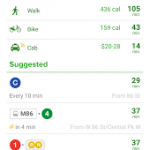
Combines all possible modes to give you the *best* options
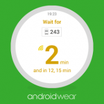
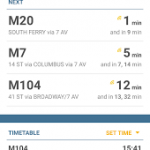
Real time data to know when your bus / train will arrive
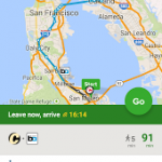
Your ETA for any trip
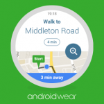
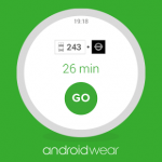
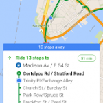
GO mode: step-by-step directions in real time
“Get Off” notifications, you’ll never miss a stop again
MAPS AVAILABLE OFFLINE
COMPREHENSIVE TRANSIT
Subway / metro
Bus & vans
Bike / cycle sharing + personal bike
Train / rail / tram / trolley
Ferry
Car sharing with Car2go
UBER / TAXI INTEGRATION
Get Uber directly through the app
STATUS ALERTS IN REAL TIME
Get notified when there‘s a service alert on your favorite lines
Find alternatives to disrupted routes
Integrated Twitter from agencies
Next bus & schedules / timetables – all in real time
PERSONALIZE THE APP
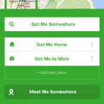
Save frequently used places
Save stops, lines & trips
Get notifications on favorite lines
No login required to use the app, we respect your anonymity
INTEGRATIONS & PARTNERSHIPS
Uber (book through us)
Car2go (find the closest car share)
Foursquare and Yelp for search
Twitter (live feeds from transit agencies)
SHARE YOUR LOCATION
Send GPS coordinates & map location to anyone
Works with SMS, WhatsApp, Twitter or email
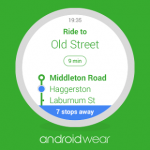
ANDROID WEAR
Step-by-step trip instructions in real time + ambiactive (always on) mode
Smart notifications when it’s time to get off
Live disruption notifications
INTERNATIONAL COVERAGE
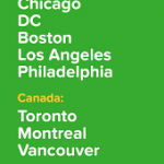
USA: New York City / NYC, San Francisco Bay Area / SF, Los Angeles / LA, Washington DC, Chicago, Boston, Philadelphia
CANADA: Toronto, Vancouver, Montreal
LATIN AMERICA: Mexico City DF, São Paulo
ASIA: Singapore, Hong Kong, Tokyo
EUROPE: London, Manchester, Birmingham, Paris, Lyon, Berlin, Hamburg, Brussels / Belgium,
Amsterdam / Randstad, Madrid, Barcelona, Milan, Rome, Lisbon
EXPANDING: VOTE for your city citymapper.com/nextcity
AGENCIES
– NYC: MTA Subway, MTA Bus, Metro North, LIRR, NICE Bus, NJ Transit & NJ Light Rail, NY Waterway Ferries, PATH, Citi Bikes
– SF BAY AREA: BART, MUNI Metro, MUNI Bus, Caltrain, AC Transit, SamTrans, Golden Gate Transit, VTA, Bike Share, SF Ferries
– LA: Metro, LA Metrolink, Big Blue Bus (BBB), DASH / LADOT
– CHICAGO: CTA Bus, Chicago ‘L’, METRA, PACE Bus, Divvy Bikes
– BOSTON: MA Port Authority (Massport), MBTA, Commuter Rail, the ‘T’, Silver Line, Hubway Bike Share, Logan Express, Charles River EZRide
– WASHINGTON DC: WMATA, DC Circulator, Metroway, Ride On (Montgomery County), ART (Arlington), DASH (Alexandria), Fairfax Connector, VRE, MARC Trains, Capital Bikeshare
– PHILADELPHIA: SEPTA, PATCO, NJ Transit (Buses, Light Rail)
– TORONTO: TTC, Go Transit, HSR, Brampton, Oakville, MiWay, YRT, Viva, Guelph Transit, GRT, Burlington, Bike Share Toronto
– VANCOUVER: TransLink, False Creek Ferries
– MONTREAL: STM, AMT, RTL, STL, Bixi, CIT
– SINGAPORE: LTA, SMRT, SBS
– HONG KONG: MTR, HK Tramways, Light Rail, Kowloon Motor Bus, Citybus, First Bus, First Ferry, Star Ferry, Discovery Bay Ferry & Bus, Park Island Ferry & Bus, Green & Red Mini Bus
KEEP IN TOUCH
If you have questions/feedback, email us at [email protected]
Facebook: facebook.com/thecitymapper
Twitter: twitter.com/Citymapper
Google+: google.com/+Citymapper
Online at: citymapper.com
Please note that the app requires data access & works best with GPS / location on.
Screenshots
What’s New
Permission
Size: 12 MB
Version: 6.5
